Every civil project starts on paper, and paper hides problems. A profile that does not match the plan, a parking lot with no fall at one corner, a storm pipe that crosses a water main with too little clearance: these are easy to miss in a drawing set and expensive to discover once the excavator is in the ground.
A pre-construction design review from the survey side catches many of these issues early. When a survey team builds a 3D model of the design for layout or machine control, the drawings are tested in a way a page-by-page read cannot match. This guide explains what that review checks, which problems it typically finds, and how to build it into your project schedule.
Key Takeaways
- Building a 3D model from the design forces every elevation, slope and tie-in to agree, which exposes conflicts that are hard to see on paper.
- Common findings include ponding areas, plan and profile mismatches, utility clashes, gaps between surfaces and outdated existing ground.
- The surveyor flags issues; the engineer of record decides how to resolve them.
- The best time for the review is after drawings are issued for construction and before the crew mobilizes, and again after each revision.
- Site Wiz includes design checks in its 3D modelling and drafting work for contractors across Canada.
What Is a Pre-Construction Design Review?
In this context, a design review is a constructability check of the civil drawings carried out while preparing survey data for construction. It is not a redesign and it does not replace the engineer’s own quality control. The goal is simple: make sure what is on the drawings can be built as shown, and that every number the field crew will use is consistent.
Because the survey team has to turn the design into stakes, cut sheets and machine control files anyway, it is in a natural position to notice when the design does not add up.
Why a 3D Model Reveals What Drawings Hide
A drawing set splits a project into plans, profiles, sections and details, often prepared by different people. Each sheet can look correct on its own. A 3D model brings them together into one surface, and the surface has to be continuous: every edge must meet the next, every slope must make sense, and every pipe must fit between the ground and the structures it connects.
When something does not fit, the model shows it. A spike in a surface, a sudden drop at a tie-in, or water flowing the wrong way in a slope analysis are all visible signs of a drawing problem. Learn more about how these models are built in our guide to 3D machine control modelling.
Common Design Issues Found Before Construction
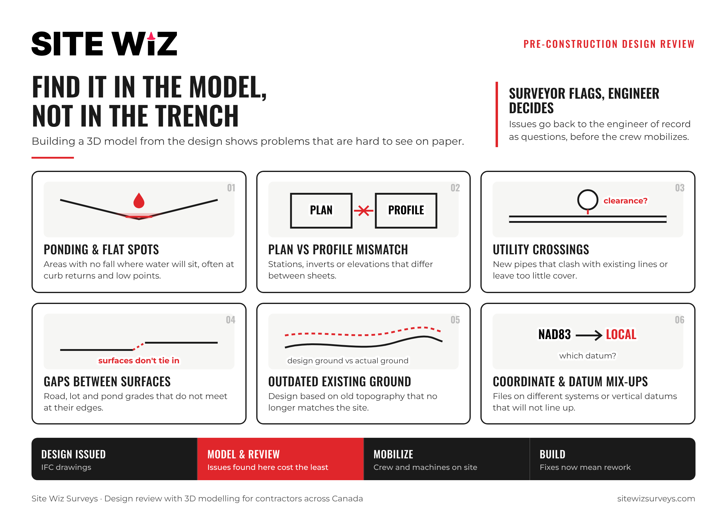
Ponding and flat spots
Areas where the finished surface has no fall, so water will sit. They often appear at curb returns, driveway letdowns and the corners of parking areas, where several design grades meet.
Plan and profile mismatches
Stations, inverts or elevations that differ between the plan view, the profile and the structure tables. Each version cannot be right at the same time, and the crew needs to know which one to build.
Utility crossings and cover
New pipes that clash with existing utilities or other new services, or that leave too little cover below the road structure. These are easier to resolve in the office than in an open trench. See our guide to utility construction layout.
Gaps between design surfaces
Road, lot, pond and landscape grades that do not meet at their edges, leaving steps or gaps that someone in the field would have to improvise.
Outdated existing ground
Designs based on old topography that no longer matches the site, so cut and fill quantities and tie-in slopes are wrong from the start. A current topographic survey avoids this.
Coordinate system and datum mix-ups
Files prepared on different horizontal systems or vertical datums, which will not line up with site control. A consistent construction survey control network is the reference that everything should match.
How the Review Is Done
- Collect the current design. The full issued-for-construction drawing set, CAD files and any engineer surfaces.
- Build the model. Alignments, profiles, sections and grading are combined into finished and subgrade surfaces.
- Check continuity. Surface edges, tie-ins and slopes are reviewed in plan, in section and in 3D.
- Analyze drainage. Slope and flow checks show where water will go and where it will collect.
- Check utilities. Pipe inverts, slopes and crossings are compared against the surfaces and against each other.
- Compare with the site. The design is checked against current existing ground and site control.
- Report. Issues are listed with locations and screenshots so the engineer can answer quickly.
When to Schedule a Design Review
The most useful time is after drawings are issued for construction and before the crew and machines mobilize. At that point, answers from the engineer can be built into the schedule rather than holding up a working crew. A shorter review should also follow each design revision, because a change in one area often affects grades elsewhere.
What Happens When an Issue Is Found
The survey team does not change the design. Each issue is documented and sent to the contractor, who raises it with the engineer of record, usually as a request for information. Once the engineer responds, the model, the cut sheets and the machine control files are updated to match, so the field always works from the approved answer.
How Site Wiz Reviews Designs
Reducing rework by identifying design flaws early is a core part of how Site Wiz works. When we prepare 3D models and layout drawings, we check the design as we build and send you a clear list of anything that does not add up. Because this work is office-based, it is available to contractors across Canada.
Starting a project and want the drawings checked before you mobilize? Contact Site Wiz with your design set and schedule.
Frequently Asked Questions
Is a survey design review an engineering service?
No. The survey team checks the design for consistency and constructability and reports what it finds. The engineer of record remains responsible for the design and for any changes.
What files are needed for a design review?
The complete issued-for-construction drawing set, CAD files, any design surfaces or LandXML files, and the site control and existing ground data.
How long does a review take?
It depends on the size and complexity of the project. It is usually completed as part of building the 3D model, so it adds little time to work the project already needs.
Can a review be done after construction has started?
Yes, and it is still worthwhile for areas not yet built. The earlier it happens, the more issues can be fixed without rework.
Does a design review replace a topographic survey?
No. If the existing ground in the design is outdated, the review will point it out, but a new topographic survey is needed to correct it.